


Environment Canada has issued Winter Storm Watches for every county on the Western half of the province, though whether they will see the 20 to 30 centimeters forecasted is still up in the air.
Meteorologist Ian Hubbard says the temperature variations of the storm system makes this particular storm tough to forecast, “With this storm, things could look very different depending on which side of the storm you are on, with one side of the storm being warmer and more likely to bring rain and the other being colder and bringing more snow.”
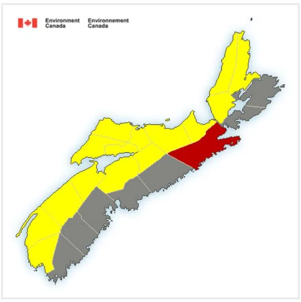
Winter Storm Watches (yellow) have been issued for the Western half of the province. Photo: Environment Canada
Currently, they are predicting the Western side of the province will see the heaviest snowfall, while communities along the Atlantic coast are more likely to see rainfall.
Hubbard says when Environment Canada releases their afternoon forecast at 4 p.m. they will have a clearer idea of the storm’s track and will be able to provide more accurate snowfall predictions. He also anticipates many of the winter storm watches will be upgraded when the forecast is released.